Volume 92, Issue 1 (2022)
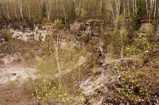
A photograph of Scott Quarry taken from the lip of the quarry on its west side, looking towards the south-east. Credit: Preston LilesArticles
Evaluation Of Measurement Data Across Eight GIS Basemaps Using Drumlins: Combining Basemaps Is Optimal
Gretchen A. Wambach and Alexander K. Stewart
Bathymetry Based Modeling of Subaxial Magma Flows Under the Mid-Atlantic Ridge, 0 to 30° N
Adam R. Tjoelker, Neil Van Kanegan, Simon Detmer, and C. Renee Sparks
Gigapan® Photogrammetry For Outcrop Description, 3d Modeling, And 3d Printing
Preston Liles, Logan Pearson, Samantha Barnett, Dakota G. Simpson, David B. Fitzpatrick, Erik B. Larson, and Maurice Testa
Sand Microtextures as Indicators of Depositional Environment – a Comparison of Fluvial, Marine and Aeolian Sediments
Brian Hanson and Diane M. Burns

